
Thank you for supporting this site ❤️
Make a donation
Make a donation
Kleven topographic map
Click on the map to display elevation.
Thank you for supporting this site ❤️
Make a donation
Make a donation
About this map
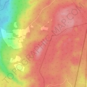
Name: Kleven topographic map, elevation, terrain.
Location: Kleven, Tidaholms kommun, Provinz Västra Götaland, Schweden (58.13977 14.10242 58.13987 14.10252)
Average elevation: 240 m
Minimum elevation: 155 m
Maximum elevation: 278 m
Thank you for supporting this site ❤️
Make a donation
Make a donation
Other topographic maps
Click on a map to view its topography, its elevation and its terrain.
Thank you for supporting this site ❤️
Make a donation
Make a donation
Thank you for supporting this site ❤️
Make a donation
Make a donation
Thank you for supporting this site ❤️
Make a donation
Make a donation
Thank you for supporting this site ❤️
Make a donation
Make a donation