
Stoneleigh topographic map
Click on the map to display elevation.
About this map
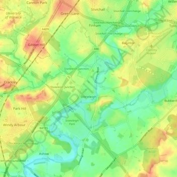
Name: Stoneleigh topographic map, elevation, terrain.
Location: Stoneleigh, Warwick, Warwickshire, England, United Kingdom (52.32408 -1.57770 52.38476 -1.47175)
Average elevation: 76 m
Minimum elevation: 49 m
Maximum elevation: 109 m
Other topographic maps
Click on a map to view its topography, its elevation and its terrain.
Rowington Green
United Kingdom > England > Warwickshire > Warwick > Rowington
Average elevation: 114 m
Hampton on the Hill
United Kingdom > England > Warwickshire > Warwick > Hampton on the Hill
Average elevation: 75 m