
Thank you for supporting this site ❤️
Make a donation
Make a donation
Sint-Pieters topographic map
Click on the map to display elevation.
Thank you for supporting this site ❤️
Make a donation
Make a donation
About this map
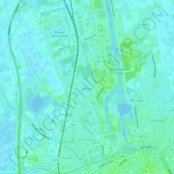
Name: Sint-Pieters topographic map, elevation, terrain.
Location: Sint-Pieters, Brugge, West-Vlaanderen, België (51.21725 3.18833 51.25258 3.22725)
Average elevation: 3 m
Minimum elevation: -3 m
Maximum elevation: 9 m
Thank you for supporting this site ❤️
Make a donation
Make a donation
Other topographic maps
Click on a map to view its topography, its elevation and its terrain.