
Thank you for supporting this site ❤️
Make a donation
Make a donation
Eden Isle topographic map
Click on the map to display elevation.
Thank you for supporting this site ❤️
Make a donation
Make a donation
About this map
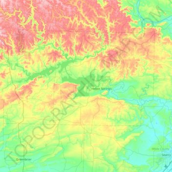
Name: Eden Isle topographic map, elevation, terrain.
Location: Eden Isle, Cleburne County, Arkansas, United States (35.18591 -92.42348 35.82591 -91.78348)
Average elevation: 215 m
Minimum elevation: 61 m
Maximum elevation: 514 m
Thank you for supporting this site ❤️
Make a donation
Make a donation
Other topographic maps
Click on a map to view its topography, its elevation and its terrain.