
Thank you for supporting this site ❤️
Make a donation
Make a donation
Gronig topographic map
Click on the map to display elevation.
Thank you for supporting this site ❤️
Make a donation
Make a donation
About this map
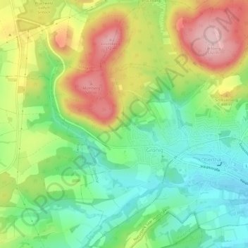
Name: Gronig topographic map, elevation, terrain.
Location: Gronig, Oberthal, Landkreis St. Wendel, Saarland, Deutschland (49.49833 7.04813 49.53488 7.08009)
Average elevation: 393 m
Minimum elevation: 303 m
Maximum elevation: 520 m
Thank you for supporting this site ❤️
Make a donation
Make a donation
Other topographic maps
Click on a map to view its topography, its elevation and its terrain.