
Thank you for supporting this site ❤️
Make a donation
Make a donation
Alstätte topographic map
Click on the map to display elevation.
Thank you for supporting this site ❤️
Make a donation
Make a donation
About this map
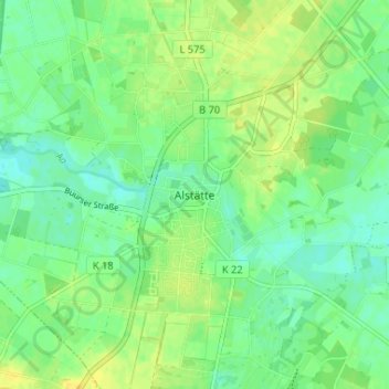
Name: Alstätte topographic map, elevation, terrain.
Location: Alstätte, Ahaus, Kreis Borken, Nordrhein-Westfalen, Deutschland (52.10849 6.89419 52.14849 6.93419)
Average elevation: 45 m
Minimum elevation: 35 m
Maximum elevation: 56 m
Thank you for supporting this site ❤️
Make a donation
Make a donation
Other topographic maps
Click on a map to view its topography, its elevation and its terrain.