
Thank you for supporting this site ❤️
Make a donation
Make a donation
La Gare topographic map
Click on the map to display elevation.
Thank you for supporting this site ❤️
Make a donation
Make a donation
About this map
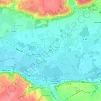
Name: La Gare topographic map, elevation, terrain.
Average elevation: 73 m
Minimum elevation: 50 m
Maximum elevation: 130 m
Thank you for supporting this site ❤️
Make a donation
Make a donation
Other topographic maps
Click on a map to view its topography, its elevation and its terrain.
Le Loir
France > Pays de la Loire > Sarthe > La Chartre-sur-le-Loir > Grand Pré de la Vallée
Average elevation: 71 m