
Thank you for supporting this site ❤️
Make a donation
Make a donation
Hurst Springs topographic map
Click on the map to display elevation.
Thank you for supporting this site ❤️
Make a donation
Make a donation
About this map
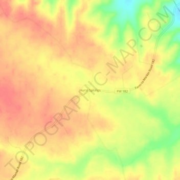
Name: Hurst Springs topographic map, elevation, terrain.
Location: Hurst Springs, Coryell County, Texas, United States (31.64571 -97.71419 31.68571 -97.67419)
Average elevation: 308 m
Minimum elevation: 267 m
Maximum elevation: 328 m
Thank you for supporting this site ❤️
Make a donation
Make a donation
Other topographic maps
Click on a map to view its topography, its elevation and its terrain.