
Thank you for supporting this site ❤️
Make a donation
Make a donation
Soapstone topographic map
Click on the map to display elevation.
Thank you for supporting this site ❤️
Make a donation
Make a donation
About this map
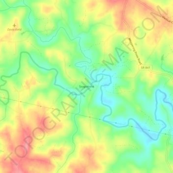
Name: Soapstone topographic map, elevation, terrain.
Location: Soapstone, Pittsylvania County, Virginia, United States (36.65264 -79.66531 36.69264 -79.62531)
Average elevation: 245 m
Minimum elevation: 203 m
Maximum elevation: 289 m
Thank you for supporting this site ❤️
Make a donation
Make a donation
Other topographic maps
Click on a map to view its topography, its elevation and its terrain.