
Thank you for supporting this site ❤️
Make a donation
Make a donation
Waleska topographic map
Click on the map to display elevation.
Thank you for supporting this site ❤️
Make a donation
Make a donation
About this map
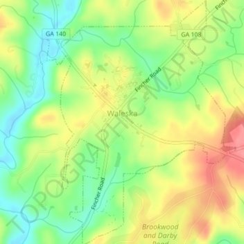
Name: Waleska topographic map, elevation, terrain.
Location: Waleska, Cherokee County, Georgia, United States (34.30116 -84.56302 34.32971 -84.53611)
Average elevation: 335 m
Minimum elevation: 296 m
Maximum elevation: 378 m
Thank you for supporting this site ❤️
Make a donation
Make a donation
Other topographic maps
Click on a map to view its topography, its elevation and its terrain.
Thank you for supporting this site ❤️
Make a donation
Make a donation
Thank you for supporting this site ❤️
Make a donation
Make a donation