
Thank you for supporting this site ❤️
Make a donation
Make a donation
Cranes Mill topographic map
Click on the map to display elevation.
Thank you for supporting this site ❤️
Make a donation
Make a donation
About this map
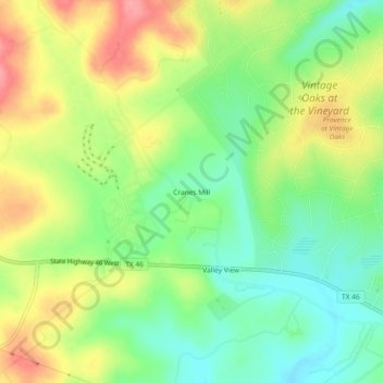
Name: Cranes Mill topographic map, elevation, terrain.
Location: Cranes Mill, Comal County, Texas, United States (29.76084 -98.29910 29.80084 -98.25910)
Average elevation: 361 m
Minimum elevation: 320 m
Maximum elevation: 414 m
Thank you for supporting this site ❤️
Make a donation
Make a donation
Other topographic maps
Click on a map to view its topography, its elevation and its terrain.