
Thank you for supporting this site ❤️
Make a donation
Make a donation
Comunaglia topographic map
Click on the map to display elevation.
Thank you for supporting this site ❤️
Make a donation
Make a donation
About this map
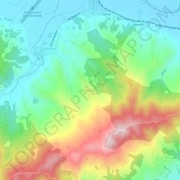
Name: Comunaglia topographic map, elevation, terrain.
Location: Comunaglia, Umbertide, Perugia, Umbria, 06019, Italia (43.31698 12.21589 43.35698 12.25589)
Average elevation: 389 m
Minimum elevation: 252 m
Maximum elevation: 634 m
Thank you for supporting this site ❤️
Make a donation
Make a donation