Lane End topographic map
Click on the map to display elevation.
About this map
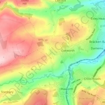
Name: Lane End topographic map, elevation, terrain.
Average elevation: 240 m
Minimum elevation: 133 m
Maximum elevation: 353 m

Click on the map to display elevation.
Name: Lane End topographic map, elevation, terrain.
Average elevation: 240 m
Minimum elevation: 133 m
Maximum elevation: 353 m