
Thank you for supporting this site ❤️
Make a donation
Make a donation
Wahlscheid topographic map
Click on the map to display elevation.
Thank you for supporting this site ❤️
Make a donation
Make a donation
Wahlscheid
Wahlscheid ist ein Stadtteil von Lohmar im Rhein-Sieg-Kreis in Nordrhein-Westfalen. Bis zum 1. August 1969 war Wahlscheid eine eigenständige Gemeinde, zu der auch die heutigen Lohmarer Stadtteile Agger, Dahlhaus, Durbusch, Hausen, Höffen, Honrath, Hove, Mackenbach, Münchhof, Neuhonrath, Oberstehöhe und Scheid gehörten.
Thank you for supporting this site ❤️
Make a donation
Make a donation
About this map
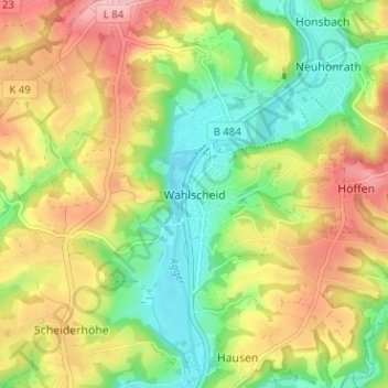
Name: Wahlscheid topographic map, elevation, terrain.
Average elevation: 136 m
Minimum elevation: 68 m
Maximum elevation: 218 m
Thank you for supporting this site ❤️
Make a donation
Make a donation
Other topographic maps
Click on a map to view its topography, its elevation and its terrain.