Geolocate
👉 Easily get elevation data in JSON, GeoTIFF and KML formats using Elevation API
Thank you for supporting this site ❤️
Make a donation

Kochi topographic map

Click on the map to display elevation.

👉 Easily get elevation data in JSON, GeoTIFF and KML formats using Elevation API
Thank you for supporting this site ❤️
Make a donation

About this map

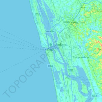
Name: Kochi topographic map, elevation, terrain.

Location: Kochi, Ernakulam, Kerala, 628002, India (9.80339 76.09366 10.12339 76.41366)

Average elevation: 4 m

Minimum elevation: -4 m

Maximum elevation: 75 m