
Thank you for supporting this site ❤️
Make a donation
Make a donation
Cherchell topographic map
Click on the map to display elevation.
Thank you for supporting this site ❤️
Make a donation
Make a donation
About this map
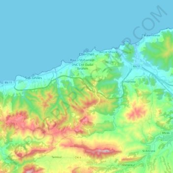
Name: Cherchell topographic map, elevation, terrain.
Location: Cherchell, Cherchell District, Tipaza, Algeria (36.51390 2.13614 36.63464 2.35667)
Average elevation: 159 m
Minimum elevation: -2 m
Maximum elevation: 702 m
Thank you for supporting this site ❤️
Make a donation
Make a donation