
Nottinghamshire topographic map
Interactive map
Click on the map to display elevation.
About this map
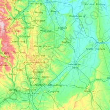
Name: Nottinghamshire topographic map, elevation, terrain.
Location: Nottinghamshire, Engeland, Verenigd Koninkrijk (52.78942 -1.34459 53.50250 -0.66626)
Average elevation: 74 m
Minimum elevation: -1 m
Maximum elevation: 433 m
Other topographic maps
Click on a map to view its topography, its elevation and its terrain.
Mansfield (Nottinghamshire)
Verenigd Koninkrijk > Engeland > Nottinghamshire
Mansfield (Nottinghamshire), Nottinghamshire, Engeland, Verenigd Koninkrijk
Average elevation: 117 m
Cotgrave
Verenigd Koninkrijk > Engeland > Nottinghamshire > Rushcliffe
Cotgrave, Rushcliffe, Nottinghamshire, Engeland, Verenigd Koninkrijk
Average elevation: 54 m