
Thank you for supporting this site ❤️
Make a donation
Make a donation
Obereichsel topographic map
Click on the map to display elevation.
Thank you for supporting this site ❤️
Make a donation
Make a donation
About this map
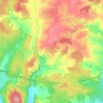
Name: Obereichsel topographic map, elevation, terrain.
Average elevation: 405 m
Minimum elevation: 310 m
Maximum elevation: 482 m
Thank you for supporting this site ❤️
Make a donation
Make a donation
Other topographic maps
Click on a map to view its topography, its elevation and its terrain.
79618
Deutschland > Baden-Württemberg > Landkreis Lörrach > Rheinfelden (Baden) > Niedereichsel
Average elevation: 374 m