
Soeda topographic map
Interactive map
Click on the map to display elevation.
About this map
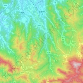
Name: Soeda topographic map, elevation, terrain.
Location: Soeda, 田川郡, Préfecture de Fukuoka, 824-0603, Japon (33.44682 130.81017 33.59201 130.94989)
Average elevation: 384 m
Minimum elevation: 43 m
Maximum elevation: 1,176 m