
Thank you for supporting this site ❤️
Make a donation
Make a donation
Chemerong small Waterfall topographic map
Click on the map to display elevation.
Thank you for supporting this site ❤️
Make a donation
Make a donation
About this map
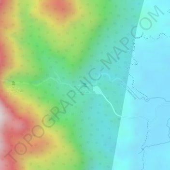
Name: Chemerong small Waterfall topographic map, elevation, terrain.
Location: Chemerong small Waterfall, Dungun, Terengganu, Malaysia (4.65894 103.00081 4.65904 103.00091)
Average elevation: 242 m
Minimum elevation: 29 m
Maximum elevation: 690 m
Thank you for supporting this site ❤️
Make a donation
Make a donation
Other topographic maps
Click on a map to view its topography, its elevation and its terrain.