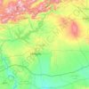
Taurus Mountains topographic map
Click on the map to display elevation.
Taurus Mountains
The mountains have a Mediterranean climate, with dry summers and rainy winters. Temperatures vary with elevation, with warm winters on the lower coastal slopes and cold winters in the high mountains and in the interior.
About this map

Name: Taurus Mountains topographic map, elevation, terrain.
Location: Taurus Mountains, Mediterranean Region, Turkey (36.01912 30.85785 38.39011 36.11961)
Average elevation: 828 m
Minimum elevation: -1 m
Maximum elevation: 3,578 m
Other topographic maps
Click on a map to view its topography, its elevation and its terrain.
Istanbul
Istanbul, located in northwestern Turkey, is a city that is uniquely situated across two continents, Europe and Asia, divided by the Bosphorus Strait. The city’s topography is characterized by a complex blend of hills, valleys, and coastal plains, which create a varied and scenic landscape. The European side…
Average elevation: 57 m

Istanbul
Istanbul, located in northwestern Turkey, is a city that is uniquely situated across two continents, Europe and Asia, divided by the Bosphorus Strait. The city’s topography is characterized by a complex blend of hills, valleys, and coastal plains, which create a varied and scenic landscape. The European side…
Average elevation: 57 m

Antalya
The highest point of the Taurus mountains is Akdağ at an altitude of 3025 metres. Located to the northwest of the city centre and at a distance of 50 km (31 mi) is the Saklıkent ski and recreation centre on Beydağları. Here one can ski and then go down to the shore and into the sea during the months of…
Average elevation: 644 m
Ankara
Ankara has a cold semi-arid climate (Köppen climate classification: BSk). Under the Trewartha climate classification, Ankara has a temperate humid continental climate (Dc). Due to its elevation and inland location, Ankara has cold and snowy winters, and hot and dry summers. Rainfall occurs mostly during the…
Average elevation: 1,082 m

Anatolia
Anatolia (Turkish: Anadolu), also known as Asia Minor, is a large peninsula or a region in Turkey, constituting most of its contemporary territory. Geographically, the Anatolian region is bounded by the Mediterranean Sea to the south, the Aegean Sea to the west, the Turkish Straits to the north-west, and the…
Average elevation: 952 m



Istanbul
Istanbul, located in northwestern Turkey, is a city that is uniquely situated across two continents, Europe and Asia, divided by the Bosphorus Strait. The city’s topography is characterized by a complex blend of hills, valleys, and coastal plains, which create a varied and scenic landscape. The European side…
Average elevation: 57 m
Ankara
Ankara has a cold semi-arid climate (Köppen climate classification: BSk). Under the Trewartha climate classification, Ankara has a temperate humid continental climate (Dc). Due to its elevation and inland location, Ankara has cold and snowy winters, and hot and dry summers. Rainfall occurs mostly during the…
Average elevation: 1,082 m
Antalya
While the city itself only has modest elevation changes, Antalya has high mountains in all directions to its interior. With moisture being trapped, the local climate thus has high winter rainfall, while the interior bay setting result in very hot summers for a coastal city.
Average elevation: 117 m



Mount Ararat
Mount Ararat is a snow-capped and dormant compound volcano in the extreme east of Turkey. It consists of two major volcanic cones: Greater Ararat and Little Ararat. Greater Ararat is the highest peak in Turkey and the Armenian Highland with an elevation of 5,137 m (16,854 ft); Little Ararat's elevation is…
Average elevation: 4,582 m

Anatolia
Anatolia (Turkish: Anadolu), also known as Asia Minor, is a peninsula in West Asia that makes up the majority of the land area of Turkey. It is the westernmost protrusion of Asia and is geographically bounded by the Mediterranean Sea to the south, the Aegean Sea to the west, the Turkish Straits to the…
Average elevation: 518 m


Cappadocia
The area was featured in several films due to its topography. The 1983 Italian/French/Turkish film Yor, the Hunter from the Future was filmed in Cappadocia. The region was used for the 1989 science fiction film Slipstream to depict a cult of wind worshippers. In 2010 and early 2011, the film Ghost Rider:…
Average elevation: 1,167 m







Gaziantep
The plan introduced several important changes to the city's transportation network. One of the most important was the addition of a rail line to connect Gaziantep to the national rail system. Up to now, Turkish railway construction had ignored Gaziantep (partly because of its mountainous surroundings); a…
Average elevation: 880 m





Armutlu Peninsula
The peninsula is actually a part of Samanlı Mountains, a mountain range lying between Bolu Mountains and Bozburun. The peak of the mountains within the peninsula is Taz Mountain with an altitude of 921 m (3,022 ft). The mountains are covered with forests.
Average elevation: 180 m




Denizli
Denizli is an industrial city in the southwestern part of Turkey and the eastern end of the alluvial valley formed by the river Büyük Menderes, where the plain reaches an elevation of about three hundred and fifty metres (1,148 ft). Denizli is located in the country's Aegean Region.
Average elevation: 743 m


Yıldırım
It is at the foot of Mt. Uludağ, at 150–155 metres in elevation. Kestel and Gürsu are to its west, and the flat lands of Demirtaş, a subdistrict of Osmangazi, are to its north. The Bursa-Ankara highway passes through it. With Osmangazi and Nilüfer, Yıldırım covers the Bursa agglomeration.
Average elevation: 787 m


Çaykara
Çaykara (Romeika: Κατωχώρι, Kadahor) is a municipality and district of Trabzon Province, Turkey. Its area is 574 km2, and its population is 13,070 (2022). As of 2023, the Mayor of Çaykara is Hanefi Tok (AKP). Çaykara village lies in a V-shaped valley along the Solaklı River in the Pontic Mountains,…
Average elevation: 1,788 m

Sivrihisar
Sivrihisar is a municipality and district of Eskişehir Province, Turkey. Its area is 2,748 km2, and its population is 20,087 (2022). Its elevation is 1,070 m (3,510 ft).
Average elevation: 928 m