
Thank you for supporting this site ❤️
Make a donation
Make a donation
Winter Haven topographic map
Click on the map to display elevation.
Thank you for supporting this site ❤️
Make a donation
Make a donation
About this map
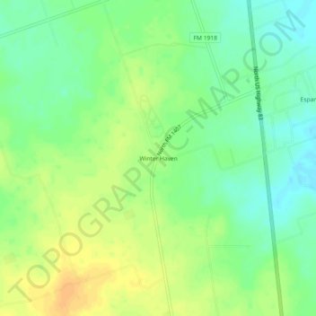
Name: Winter Haven topographic map, elevation, terrain.
Location: Winter Haven, Dimmit County, Texas, United States (28.59970 -99.87756 28.63970 -99.83756)
Average elevation: 177 m
Minimum elevation: 163 m
Maximum elevation: 192 m
Thank you for supporting this site ❤️
Make a donation
Make a donation
Other topographic maps
Click on a map to view its topography, its elevation and its terrain.