
Thank you for supporting this site ❤️
Make a donation
Make a donation
Wilkinson topographic map
Click on the map to display elevation.
Thank you for supporting this site ❤️
Make a donation
Make a donation
About this map
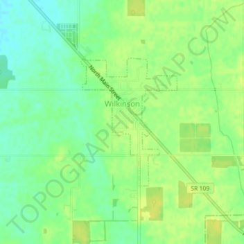
Name: Wilkinson topographic map, elevation, terrain.
Location: Wilkinson, Hancock County, Indiana, United States (39.87678 -85.61488 39.89093 -85.60097)
Average elevation: 307 m
Minimum elevation: 296 m
Maximum elevation: 314 m
Thank you for supporting this site ❤️
Make a donation
Make a donation
Other topographic maps
Click on a map to view its topography, its elevation and its terrain.
Thank you for supporting this site ❤️
Make a donation
Make a donation
Thank you for supporting this site ❤️
Make a donation
Make a donation
Thank you for supporting this site ❤️
Make a donation
Make a donation
Thank you for supporting this site ❤️
Make a donation
Make a donation