
Thank you for supporting this site ❤️
Make a donation
Make a donation
New Boston topographic map
Click on the map to display elevation.
Thank you for supporting this site ❤️
Make a donation
Make a donation
About this map
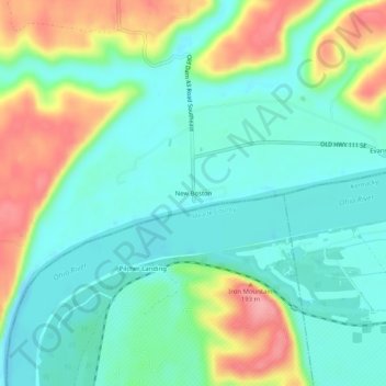
Name: New Boston topographic map, elevation, terrain.
Location: New Boston, Harrison County, Indiana, United States (37.97980 -86.03080 38.01980 -85.99080)
Average elevation: 154 m
Minimum elevation: 118 m
Maximum elevation: 230 m
Thank you for supporting this site ❤️
Make a donation
Make a donation
Other topographic maps
Click on a map to view its topography, its elevation and its terrain.