
Thank you for supporting this site ❤️
Make a donation
Make a donation
Bellfountain topographic map
Click on the map to display elevation.
Thank you for supporting this site ❤️
Make a donation
Make a donation
About this map
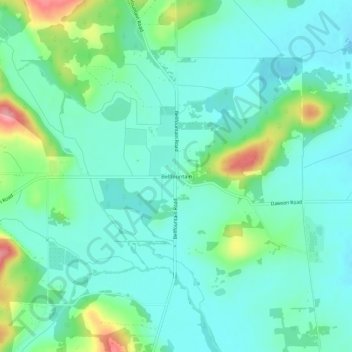
Name: Bellfountain topographic map, elevation, terrain.
Location: Bellfountain, Benton County, Oregon, United States (44.34376 -123.37553 44.38376 -123.33553)
Average elevation: 107 m
Minimum elevation: 79 m
Maximum elevation: 194 m
Thank you for supporting this site ❤️
Make a donation
Make a donation
Other topographic maps
Click on a map to view its topography, its elevation and its terrain.