
Thank you for supporting this site ❤️
Make a donation
Make a donation
Powderly topographic map
Click on the map to display elevation.
Thank you for supporting this site ❤️
Make a donation
Make a donation
About this map
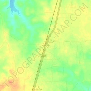
Name: Powderly topographic map, elevation, terrain.
Location: Powderly, Lamar County, Texas, 75473, United States (33.79122 -95.54440 33.83122 -95.50440)
Average elevation: 158 m
Minimum elevation: 136 m
Maximum elevation: 173 m
Thank you for supporting this site ❤️
Make a donation
Make a donation
Other topographic maps
Click on a map to view its topography, its elevation and its terrain.