
Thank you for supporting this site ❤️
Make a donation
Make a donation
Cub Run topographic map
Click on the map to display elevation.
Thank you for supporting this site ❤️
Make a donation
Make a donation
About this map
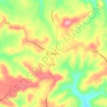
Name: Cub Run topographic map, elevation, terrain.
Location: Cub Run, Hart County, Kentucky, 42729, United States (37.28561 -86.08080 37.32561 -86.04080)
Average elevation: 225 m
Minimum elevation: 154 m
Maximum elevation: 281 m
Thank you for supporting this site ❤️
Make a donation
Make a donation
Other topographic maps
Click on a map to view its topography, its elevation and its terrain.