
Thank you for supporting this site ❤️
Make a donation
Make a donation
Marble Valley topographic map
Click on the map to display elevation.
Thank you for supporting this site ❤️
Make a donation
Make a donation
About this map
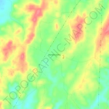
Name: Marble Valley topographic map, elevation, terrain.
Location: Marble Valley, Coosa County, Alabama, United States (33.02401 -86.47192 33.06401 -86.43192)
Average elevation: 170 m
Minimum elevation: 133 m
Maximum elevation: 207 m
Thank you for supporting this site ❤️
Make a donation
Make a donation
Other topographic maps
Click on a map to view its topography, its elevation and its terrain.