
Thank you for supporting this site ❤️
Make a donation
Make a donation
Riley topographic map
Click on the map to display elevation.
Thank you for supporting this site ❤️
Make a donation
Make a donation
About this map
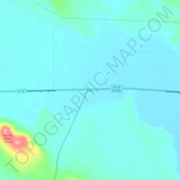
Name: Riley topographic map, elevation, terrain.
Location: Riley, Harney County, Oregon, United States (43.52193 -119.52548 43.56193 -119.48548)
Average elevation: 1,295 m
Minimum elevation: 1,279 m
Maximum elevation: 1,402 m
Thank you for supporting this site ❤️
Make a donation
Make a donation
Other topographic maps
Click on a map to view its topography, its elevation and its terrain.