
Thank you for supporting this site ❤️
Make a donation
Make a donation
Jasmine Hill topographic map
Click on the map to display elevation.
Thank you for supporting this site ❤️
Make a donation
Make a donation
About this map
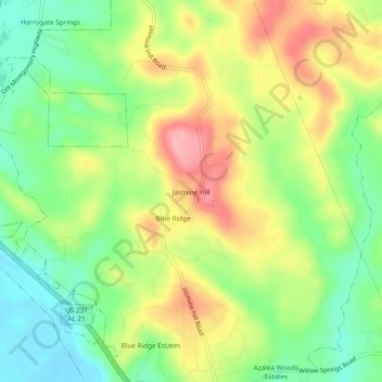
Name: Jasmine Hill topographic map, elevation, terrain.
Location: Jasmine Hill, Elmore County, Alabama, 36093, United States (32.47541 -86.20830 32.51541 -86.16830)
Average elevation: 97 m
Minimum elevation: 42 m
Maximum elevation: 164 m
Thank you for supporting this site ❤️
Make a donation
Make a donation