
Thank you for supporting this site ❤️
Make a donation
Make a donation
Holl topographic map
Click on the map to display elevation.
Thank you for supporting this site ❤️
Make a donation
Make a donation
Holl
Holl liegt im Nordosten des Stadtgebiets von Lohmar. Umliegende Ortschaften und Weiler sind Kern im Norden, Kuckenbach im Südosten, Oberstehöhe im Süden, Grünenborn im Südwesten, Neuhonrath im Westen, Hähngen und Hohnenberg im Nordwesten.
Thank you for supporting this site ❤️
Make a donation
Make a donation
About this map
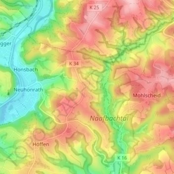
Name: Holl topographic map, elevation, terrain.
Average elevation: 165 m
Minimum elevation: 75 m
Maximum elevation: 249 m
Thank you for supporting this site ❤️
Make a donation
Make a donation