
Thank you for supporting this site ❤️
Make a donation
Make a donation
Edgemont topographic map
Click on the map to display elevation.
Thank you for supporting this site ❤️
Make a donation
Make a donation
About this map
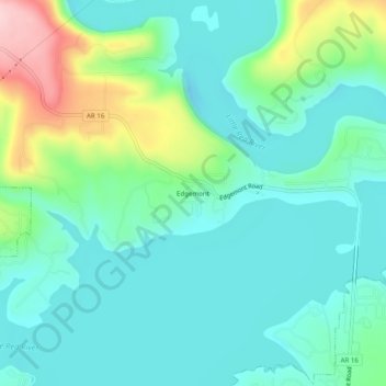
Name: Edgemont topographic map, elevation, terrain.
Location: Edgemont, Cleburne County, Arkansas, 72044, United States (35.58230 -92.21626 35.62230 -92.17626)
Average elevation: 178 m
Minimum elevation: 124 m
Maximum elevation: 345 m
Thank you for supporting this site ❤️
Make a donation
Make a donation
Other topographic maps
Click on a map to view its topography, its elevation and its terrain.