
Thank you for supporting this site ❤️
Make a donation
Make a donation
Ben Lomond topographic map
Click on the map to display elevation.
Thank you for supporting this site ❤️
Make a donation
Make a donation
About this map
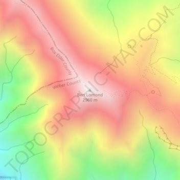
Name: Ben Lomond topographic map, elevation, terrain.
Location: Ben Lomond, Weber County, Utah, 84414, United States (41.36320 -111.96073 41.36330 -111.96063)
Average elevation: 2,453 m
Minimum elevation: 1,783 m
Maximum elevation: 2,952 m
Thank you for supporting this site ❤️
Make a donation
Make a donation
Other topographic maps
Click on a map to view its topography, its elevation and its terrain.
Thank you for supporting this site ❤️
Make a donation
Make a donation
Thank you for supporting this site ❤️
Make a donation
Make a donation