
Saint-André topographic map
Interactive map
Click on the map to display elevation.
About this map
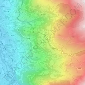
Name: Saint-André topographic map, elevation, terrain.
Average elevation: 935 m
Minimum elevation: 437 m
Maximum elevation: 1,700 m
Other topographic maps
Click on a map to view its topography, its elevation and its terrain.
Souin
France > Occitanie > Hautes-Pyrénées > Artalens-Souin
Souin, Artalens-Souin, Argelès-Gazost, Hautes-Pyrénées, Occitanie, France métropolitaine, 65400, France
Average elevation: 782 m