
Thank you for supporting this site ❤️
Make a donation
Make a donation
Xaltianguis topographic map
Click on the map to display elevation.
Thank you for supporting this site ❤️
Make a donation
Make a donation
About this map
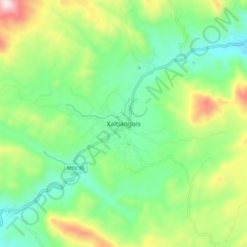
Name: Xaltianguis topographic map, elevation, terrain.
Location: Xaltianguis, Acapulco de Juárez, Guerrero, México (17.05894 -99.75377 17.13894 -99.67377)
Average elevation: 633 m
Minimum elevation: 388 m
Maximum elevation: 1,144 m
Thank you for supporting this site ❤️
Make a donation
Make a donation
Other topographic maps
Click on a map to view its topography, its elevation and its terrain.