
Murschetg topographic map
Interactive map
Click on the map to display elevation.
About this map
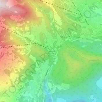
Name: Murschetg topographic map, elevation, terrain.
Location: Murschetg, Laax, Surselva, Graubünden, 7032, Schweiz (46.79930 9.24436 46.83930 9.28436)
Average elevation: 1,185 m
Minimum elevation: 782 m
Maximum elevation: 1,780 m
Other topographic maps
Click on a map to view its topography, its elevation and its terrain.
Alp Nagens
Schweiz > Graubünden > Surselva > Laax
Alp Nagens, Via Nagens, Nagens, Laax, Surselva, Graubünden, 7032, Schweiz
Average elevation: 1,898 m