
Thank you for supporting this site ❤️
Make a donation
Make a donation
Devils Bridge topographic map
Click on the map to display elevation.
Thank you for supporting this site ❤️
Make a donation
Make a donation
About this map
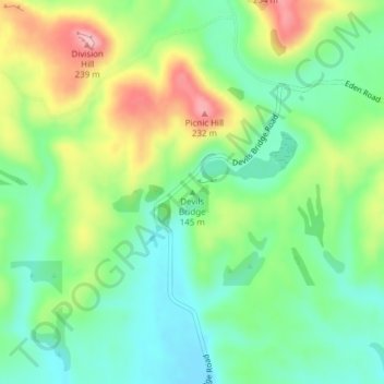
Name: Devils Bridge topographic map, elevation, terrain.
Location: Devils Bridge, Waitaki District, Otago, 9492, New Zealand (-45.04046 170.94075 -45.04036 170.94085)
Average elevation: 136 m
Minimum elevation: 79 m
Maximum elevation: 234 m
Thank you for supporting this site ❤️
Make a donation
Make a donation
Other topographic maps
Click on a map to view its topography, its elevation and its terrain.