
Petit Paradis topographic map
Interactive map
Click on the map to display elevation.
About this map
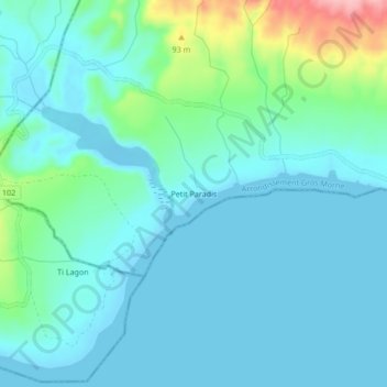
Name: Petit Paradis topographic map, elevation, terrain.
Average elevation: 28 m
Minimum elevation: -1 m
Maximum elevation: 161 m
Other topographic maps
Click on a map to view its topography, its elevation and its terrain.
Grande Plaine
Haïti > Département de l'Artibonite > Arrondissement Gros Morne > Grande Plaine
Grande Plaine, Arrondissement Gros Morne, Département de l'Artibonite, Haïti
Average elevation: 317 m
L'Arbre
Haïti > Département de l'Artibonite > Arrondissement Gros Morne
L'Arbre, Arrondissement Gros Morne, Département de l'Artibonite, Haïti
Average elevation: 41 m