
Thank you for supporting this site ❤️
Make a donation
Make a donation
Needham topographic map
Click on the map to display elevation.
Thank you for supporting this site ❤️
Make a donation
Make a donation
About this map
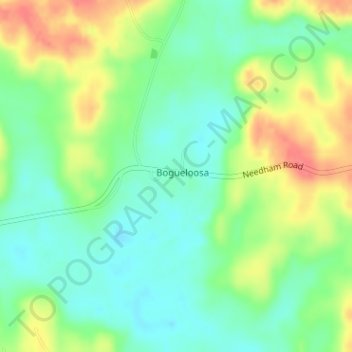
Name: Needham topographic map, elevation, terrain.
Location: Needham, Choctaw County, Alabama, United States (31.98193 -88.35011 31.99282 -88.32440)
Average elevation: 62 m
Minimum elevation: 37 m
Maximum elevation: 100 m
Thank you for supporting this site ❤️
Make a donation
Make a donation
Other topographic maps
Click on a map to view its topography, its elevation and its terrain.