
Thank you for supporting this site ❤️
Make a donation
Make a donation
Rüthi (SG) topographic map
Click on the map to display elevation.
Thank you for supporting this site ❤️
Make a donation
Make a donation
About this map
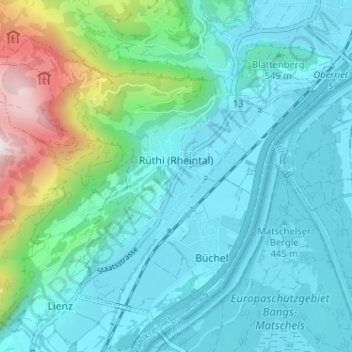
Name: Rüthi (SG) topographic map, elevation, terrain.
Location: Rüthi (SG), Wahlkreis Rheintal, St. Gallen, Switzerland (47.27661 9.50149 47.31048 9.56558)
Average elevation: 594 m
Minimum elevation: 410 m
Maximum elevation: 1,412 m
Thank you for supporting this site ❤️
Make a donation
Make a donation
Other topographic maps
Click on a map to view its topography, its elevation and its terrain.