Geolocate
👉 Easily get elevation data in JSON, GeoTIFF and KML formats using Elevation API
Thank you for supporting this site ❤️
Make a donation

Shao topographic map

Click on the map to display elevation.

👉 Easily get elevation data in JSON, GeoTIFF and KML formats using Elevation API
Thank you for supporting this site ❤️
Make a donation

About this map

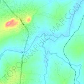
Name: Shao topographic map, elevation, terrain.

Location: Shao, Moro, Kwara, Nigeria (8.56333 4.54667 8.60333 4.58667)

Average elevation: 277 m

Minimum elevation: 253 m

Maximum elevation: 364 m