
Make a donation
Tirich Mir topographic map
Click on the map to display elevation.
Make a donation
Tirich Mir
The weather station 4,245 m (13,927 ft) above sea level lies in the Tundra climate/Alpine climate (ET) zone according to Köppen Climate Classification. On this specific altitude (4,245 m or 13,927 ft asl) we find moderately cold winters and cool summers generally above freezing. Annual mean temperature is −5.25 °C (22.55 °F), which puts the station well inside the range of continuous permafrost. The average temperature in the coldest month of January is −17.5 °C (0.5 °F) and the two hottest months of July and August have mean temperatures of 6.5 °C (43.7 °F). Average low temperatures range from −23 °C (−9 °F) in January to 0 °C (32 °F) in July and August. The summit has an Ice cap climate (EF) where no month has an average temperature above 0 °C (32 °F).
Make a donation
About this map
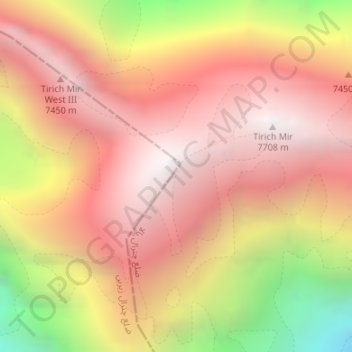
Name: Tirich Mir topographic map, elevation, terrain.
Average elevation: 6,802 m
Minimum elevation: 5,610 m
Maximum elevation: 7,666 m
Make a donation