
Thank you for supporting this site ❤️
Make a donation
Make a donation
Garhgaon topographic map
Click on the map to display elevation.
Thank you for supporting this site ❤️
Make a donation
Make a donation
About this map
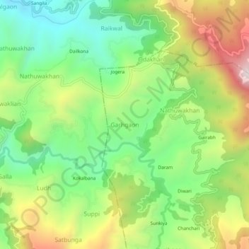
Name: Garhgaon topographic map, elevation, terrain.
Location: Garhgaon, Dhari, Nainital, Uttarakhand, 263138, India (29.44716 79.60131 29.48716 79.64131)
Average elevation: 1,814 m
Minimum elevation: 1,488 m
Maximum elevation: 2,307 m
Thank you for supporting this site ❤️
Make a donation
Make a donation