
上峡乡 topographic map
Interactive map
Click on the map to display elevation.
About this map
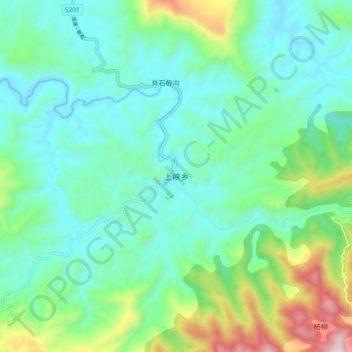
Name: 上峡乡 topographic map, elevation, terrain.
Location: 上峡乡, 宣汉县, 达州市, 四川省, 中国 (31.26645 107.98059 31.34645 108.06059)
Average elevation: 548 m
Minimum elevation: 373 m
Maximum elevation: 1,108 m
Other topographic maps
Click on a map to view its topography, its elevation and its terrain.