
Thank you for supporting this site ❤️
Make a donation
Make a donation
Ringsted topographic map
Click on the map to display elevation.
Thank you for supporting this site ❤️
Make a donation
Make a donation
About this map
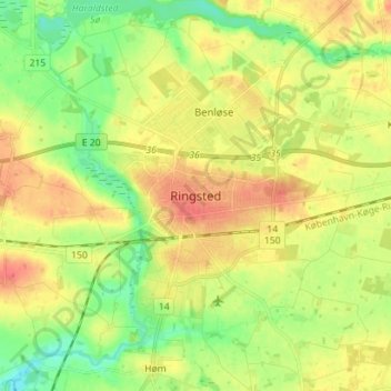
Name: Ringsted topographic map, elevation, terrain.
Location: Ringsted, Ringsted Municipality, Region Zealand, 4100, Denmark (55.40682 11.75752 55.48682 11.83752)
Average elevation: 37 m
Minimum elevation: 10 m
Maximum elevation: 66 m
Thank you for supporting this site ❤️
Make a donation
Make a donation