
Thank you for supporting this site ❤️
Make a donation
Make a donation
Ibapah topographic map
Click on the map to display elevation.
Thank you for supporting this site ❤️
Make a donation
Make a donation
Ibapah
The climate is typical of that of a high elevation Great Basin location, being semi-arid and featuring, in consequence, large differences in temperature between day and night.
Thank you for supporting this site ❤️
Make a donation
Make a donation
About this map
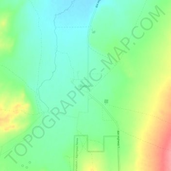
Name: Ibapah topographic map, elevation, terrain.
Location: Ibapah, Tooele County, Utah, United States (40.01733 -114.00426 40.05733 -113.96426)
Average elevation: 1,623 m
Minimum elevation: 1,593 m
Maximum elevation: 1,679 m
Thank you for supporting this site ❤️
Make a donation
Make a donation
Other topographic maps
Click on a map to view its topography, its elevation and its terrain.