
Thank you for supporting this site ❤️
Make a donation
Make a donation
Taylor Mill topographic map
Click on the map to display elevation.
Thank you for supporting this site ❤️
Make a donation
Make a donation
About this map
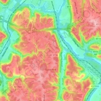
Name: Taylor Mill topographic map, elevation, terrain.
Location: Taylor Mill, Kenton County, Kentucky, 41015, United States (38.97794 -84.52537 39.04084 -84.45057)
Average elevation: 211 m
Minimum elevation: 138 m
Maximum elevation: 277 m
Thank you for supporting this site ❤️
Make a donation
Make a donation
Other topographic maps
Click on a map to view its topography, its elevation and its terrain.
Daniel Carter Beard Boyhood Home
United States > Kentucky > Kenton County > Covington
Average elevation: 157 m