
Valsad topographic map
Click on the map to display elevation.
About this map
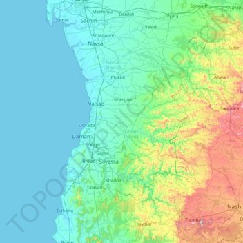
Name: Valsad topographic map, elevation, terrain.
Location: Valsad, Valsad District, Gujarat, India (19.80000 72.38333 21.20000 73.78333)
Average elevation: 176 m
Minimum elevation: -2 m
Maximum elevation: 1,271 m
Other topographic maps
Click on a map to view its topography, its elevation and its terrain.