
Thank you for supporting this site ❤️
Make a donation
Make a donation
Jackson County topographic map
Click on the map to display elevation.
Thank you for supporting this site ❤️
Make a donation
Make a donation
About this map
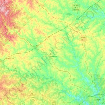
Name: Jackson County topographic map, elevation, terrain.
Location: Jackson County, Georgia, United States (33.96573 -83.81768 34.29528 -83.35705)
Average elevation: 253 m
Minimum elevation: 175 m
Maximum elevation: 399 m
Thank you for supporting this site ❤️
Make a donation
Make a donation