
Thank you for supporting this site ❤️
Make a donation
Make a donation
Wrenshall topographic map
Click on the map to display elevation.
Thank you for supporting this site ❤️
Make a donation
Make a donation
About this map
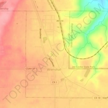
Name: Wrenshall topographic map, elevation, terrain.
Location: Wrenshall, Carlton County, Minnesota, United States (46.61258 -92.39609 46.63448 -92.36438)
Average elevation: 315 m
Minimum elevation: 242 m
Maximum elevation: 349 m
Thank you for supporting this site ❤️
Make a donation
Make a donation
Other topographic maps
Click on a map to view its topography, its elevation and its terrain.
Thank you for supporting this site ❤️
Make a donation
Make a donation
Thank you for supporting this site ❤️
Make a donation
Make a donation
Thank you for supporting this site ❤️
Make a donation
Make a donation